
AI-Driven Deforestation Monitoring Using Satellite Data
Introduction: How AI Is Transforming Deforestation Monitoring
Deforestation is one of the most critical environmental challenges facing the world today. Forests play a vital role in regulating climate, preserving biodiversity and supporting millions of livelihoods. However, rapid urbanization, infrastructure development and industrial expansion are causing large-scale forest loss at an alarming rate.
Traditional forest monitoring methods rely heavily on field surveys and manual reporting, which are time-consuming, expensive and limited in scale. This is where AI-driven deforestation monitoring using satellite data is transforming environmental protection.
At AI India Innovations, we leverage Artificial Intelligence (AI), satellite imagery and geospatial analytics to detect deforestation patterns in near real time. By analyzing satellite data using indicators like the Normalized Difference Built-up Index (NDBI), we accurately track construction expansion-one of the strongest indicators of deforestation in rapidly developing regions.
Why AI and Satellite Imagery Are Revolutionizing Deforestation Detection?
The combination of AI and satellite-based remote sensing enables environmental monitoring at a scale that was previously impossible.
Key Benefits of AI-Based Satellite Monitoring:
- Large-Scale Environmental Coverage
Satellite imagery provides continuous, high-resolution coverage across vast geographic regions.
- Time-Series Analysis
Historical satellite data allows year-over-year comparison to identify long-term deforestation trends.
- Automated AI Detection
Machine learning models automatically identify changes in land use, construction growth and forest cover loss.
- NDBI-Based Urban Expansion Tracking
Increased built-up areas strongly correlate with deforestation, making NDBI analysis a reliable proxy for forest loss detection.
Together, these technologies enable accurate, scalable and data-driven deforestation monitoring, supporting sustainable development and environmental governance.
Methodology: AI-Driven Deforestation Detection Using Satellite Data
Our AI-powered analytical framework ensures accuracy, consistency and reproducibility across multiple years of satellite data.
1. Satellite Data Collection (2017–2025)
We analyzed cloud-free satellite imagery from 2017 to 2025, ensuring consistent spatial resolution and geospatial accuracy.
This long-term dataset allowed us to:
- Track urban expansion
- Measure forest cover reduction
- Identify deforestation hotspots over time
Satellite Comparison:
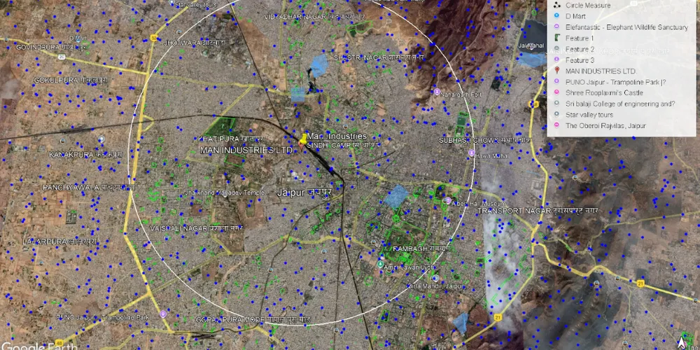
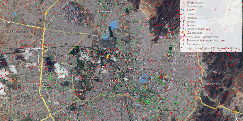
2017: Dense vegetation with minimal construction
2025: Significant urban development & visible forest loss
This temporal comparison forms the foundation of our AI-driven deforestation analysis.
2. Satellite Image Pre-processing
Before applying AI models, each satellite image underwent rigorous pre-processing to ensure reliable results:
- Area of Interest (AOI) cropping
- Geometric alignment for pixel-level accuracy
- Atmospheric and sensor distortion correction
These steps ensure consistent input data for accurate machine learning analysis.
3. NDBI Calculation and Urban Growth Analysis
The Normalized Difference Built-up Index (NDBI) was calculated for each year in the dataset.
- Higher NDBI values indicate increased construction and reduced vegetation
- Annual NDBI trends reveal the pace and intensity of urban-driven deforestation
By converting satellite imagery into quantifiable metrics, AI enables automated detection of deforestation patterns at scale.
4. Data Visualization and Key Insights
To clearly illustrate deforestation trends, we generated three analytical visualizations:
Graph 1: Construction Growth by Year
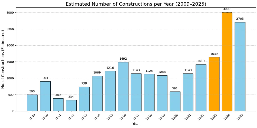
Shows a sharp rise in construction activity, particularly between 2023 and 2024, signalling accelerated deforestation.
Graph 2: Cumulative Construction Growth
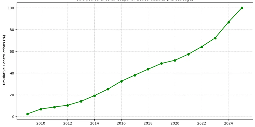
Demonstrates how small annual increases compound into significant long-term land-use change.
Graph 3: Normalized Growth Percentage
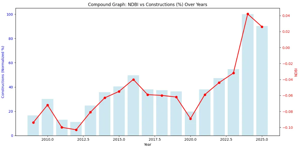
Validates AI predictions by standardizing growth trends across multiple years using NDBI values.
Key Findings from AI-Based Deforestation Analysis
1. Construction activity increased dramatically between 2017 and 2025
2. Built-up areas more than doubled, confirming rapid urban encroachment
3. Strong correlation between NDBI growth and deforestation validates the AI model’s accuracy
Real-World Applications of AI Deforestation Monitoring
AI-powered satellite analytics enable actionable insights across multiple sectors:
- Government Monitoring: Detect illegal construction and deforestation in near real time
- Urban Planning: Balance infrastructure growth with forest conservation
- Environmental Conservation: Identify deforestation hotspots for targeted reforestation
- Policy Making: Support data-backed land-use and sustainability policies
AI shifts deforestation monitoring from reactive reporting to proactive environmental protection.
Conclusion: AI Is the Future of Sustainable Forest Management
The integration of AI, satellite imagery and NDBI-based analysis represents a major breakthrough in deforestation monitoring.
Our multi-year satellite analysis clearly demonstrates the link between construction expansion and forest loss, highlighting the urgent need for data-driven environmental planning.
At AI India Innovations, we are committed to using AI for sustainability-helping governments, enterprises and organizations monitor, predict and mitigate ecological impact.
Deforestation is not a local issue-it is a global responsibility. With AI-driven intelligence, we now have the tools to protect forests and build a more sustainable future.
Partner With Us
We at AI India Innovations help organizations integrate AI, satellite analytics and geospatial intelligence for sustainability monitoring.
From AI-driven projects such as deforestation detection to infrastructure mapping and environmental risk assessment, we empower smarter, responsible decision-making.
🌱 Let AI guide sustainable growth.
